|
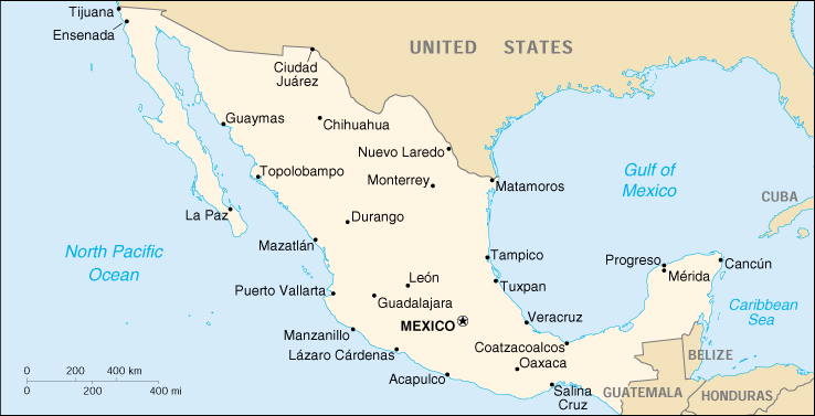
Mexico, when you drive it, is BIG. From the north west corner (at Tijuana) down to Merida in the south east, it is some 2700 miles long, and the mountainous chain running down its center makes east-west travel considerably harder than it might look on a road map. As did, when we first went there in 1961, the relative paucity of good highways. On the Mexican government's map that we used that year, the average driving time from Nuevo Laredo (across the border from Laredo, Texas, where we crossed) to Mexico City is given as 17 hours, while going from Vera Cruz on the Gulf across to Acapulco on the Pacific via Mexico City, would be about the same, during which time you would have ascended and descended maybe 9000 feet. But those were conservative estimates, at least if you weren't experienced drivers in a car with good acceleration (or a Don't-Mess-with-ME long-distance bus) and not too many slow-moving trucks and local buses to find yourself stuck behind on a two-lane undivided highway with odd dips up ahead that could conceal oncoming vehicles. And you knew, having read a guidebook or two, that if you were to have an accident of any kind you would be in very bad trouble indeed, and that you should absolutely not be driving once daylight had gone, which it did quite fast. The farthest we had driven at one time before we left Halifax on that first trip was about 75 miles, down to Green Bay. But still, there was some lovely driving that fall in Mexico, with the roads often blessedly free of traffic, and lovely landscapes, and clear blue skies, and the sun, the sun. |